Open Channel Hydraulics Made Easy
Channel Studio is a simple-to-use program that allows for the modeling of open channel systems. It is capable of computing water surface profiles for a wide range of open channels, including bridge structures, culverts, and inline weirs. This software is particularly well-suited for site development projects and offers a more intuitive user experience than HEC-RAS.
An Industry Breakthrough
Utilize a clear canvas or a base map. Proceed to sketch authentic winding river segments. Include cross-sections and perform calculations. Avoid unnecessary back-and-forth data transfers. No black box. No stress. A real breakthrough in open channel hydraulics modeling.
Easy to Learn and Use
Channel Studio boasts a comprehensive user interface that conveniently presents all the necessary elements, such as plans, sections, and profiles, in one place at all times. We have done away with bothersome dialog boxes and never-ending pull-down menus. With our smart grid-style editor, you can effortlessly compute and visualize results while conveniently editing your inputs.
At last, stand-alone open channel modeling software
Despite utilizing well-established techniques in open channel hydraulics, this software is completely innovative in its design and functionality. It is not simply a superficial user interface layered on top of government freeware. Channel Studio is a comprehensive and specialized software specifically developed for open channel modeling, requiring no additional software for its operation.
Setting Up Your Model is Fast & Easy
Simply click on a section and add your channel data. Enter up to 250 points for user-defined sections. Enhance efficiency by utilizing a TIN Surface or a pre-defined section type.
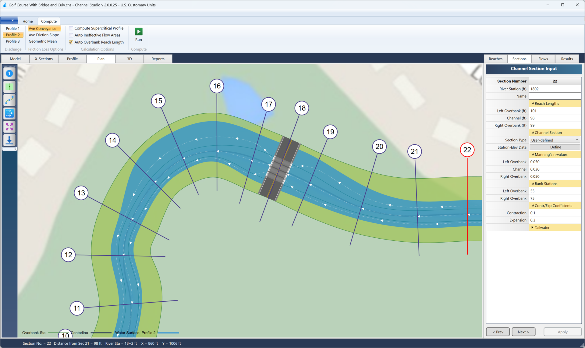
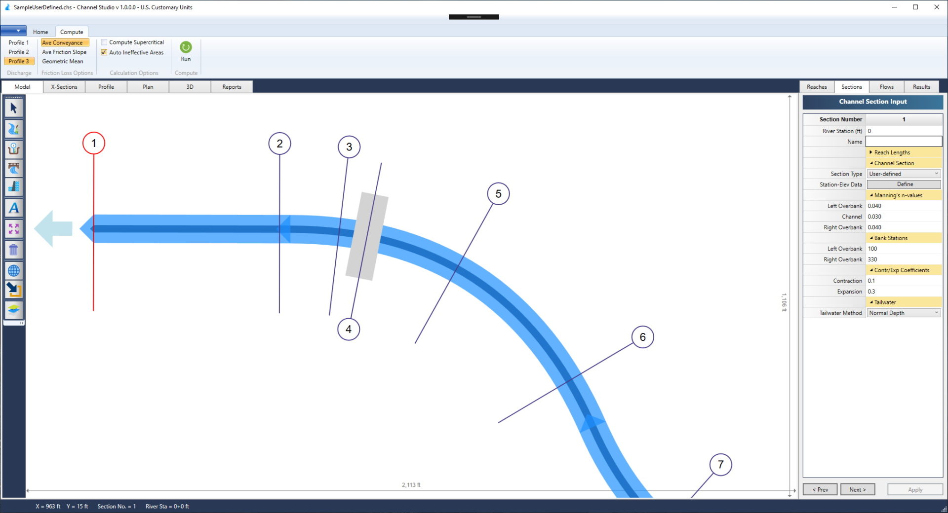
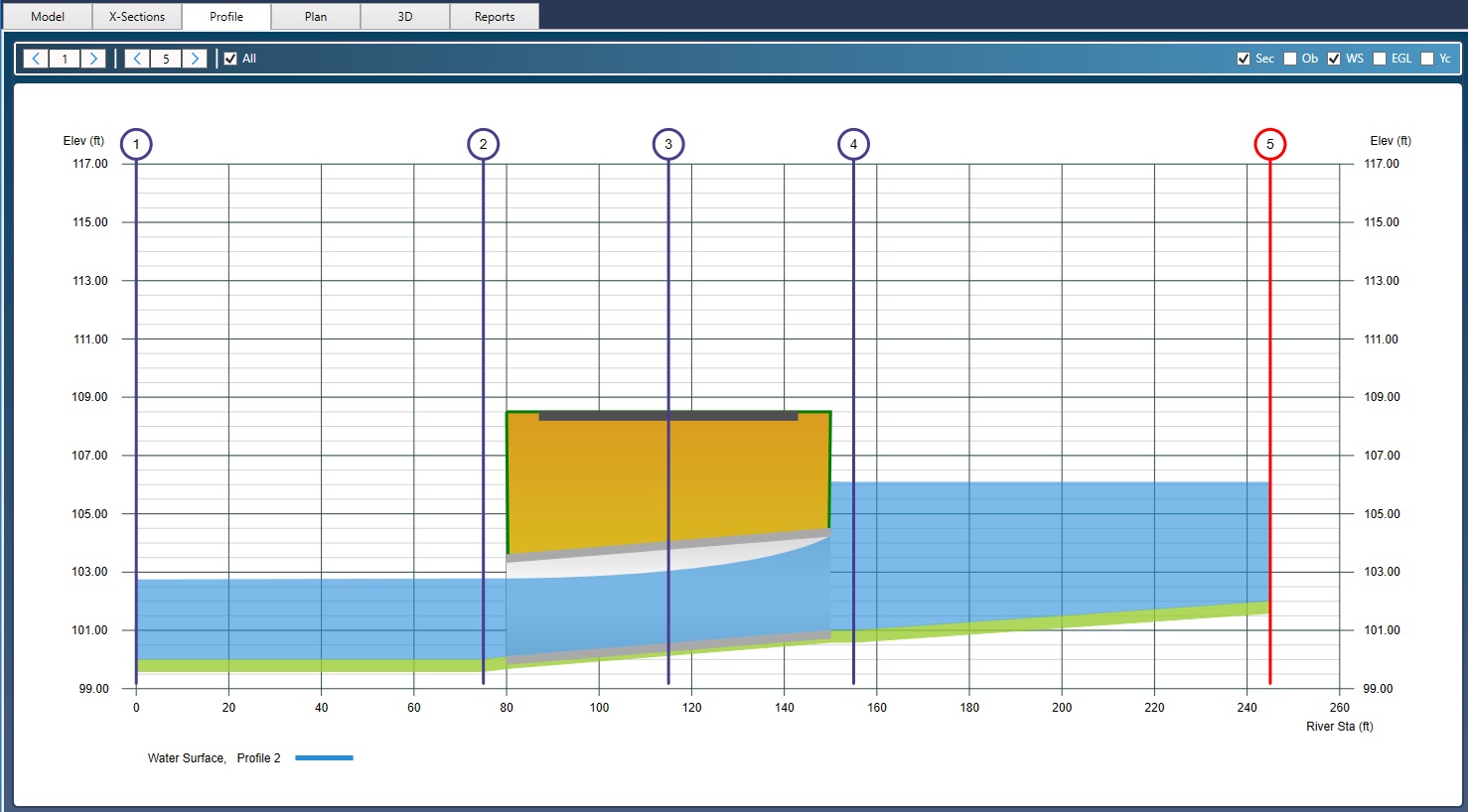
Add Cross-Sections with a Single Mouse Click
Easily add cross-sections to your model by simply rolling your mouse along the river reaches and clicking. Sections are added, automatically aligned, reach lengths computed, ineffective flow areas established and more.
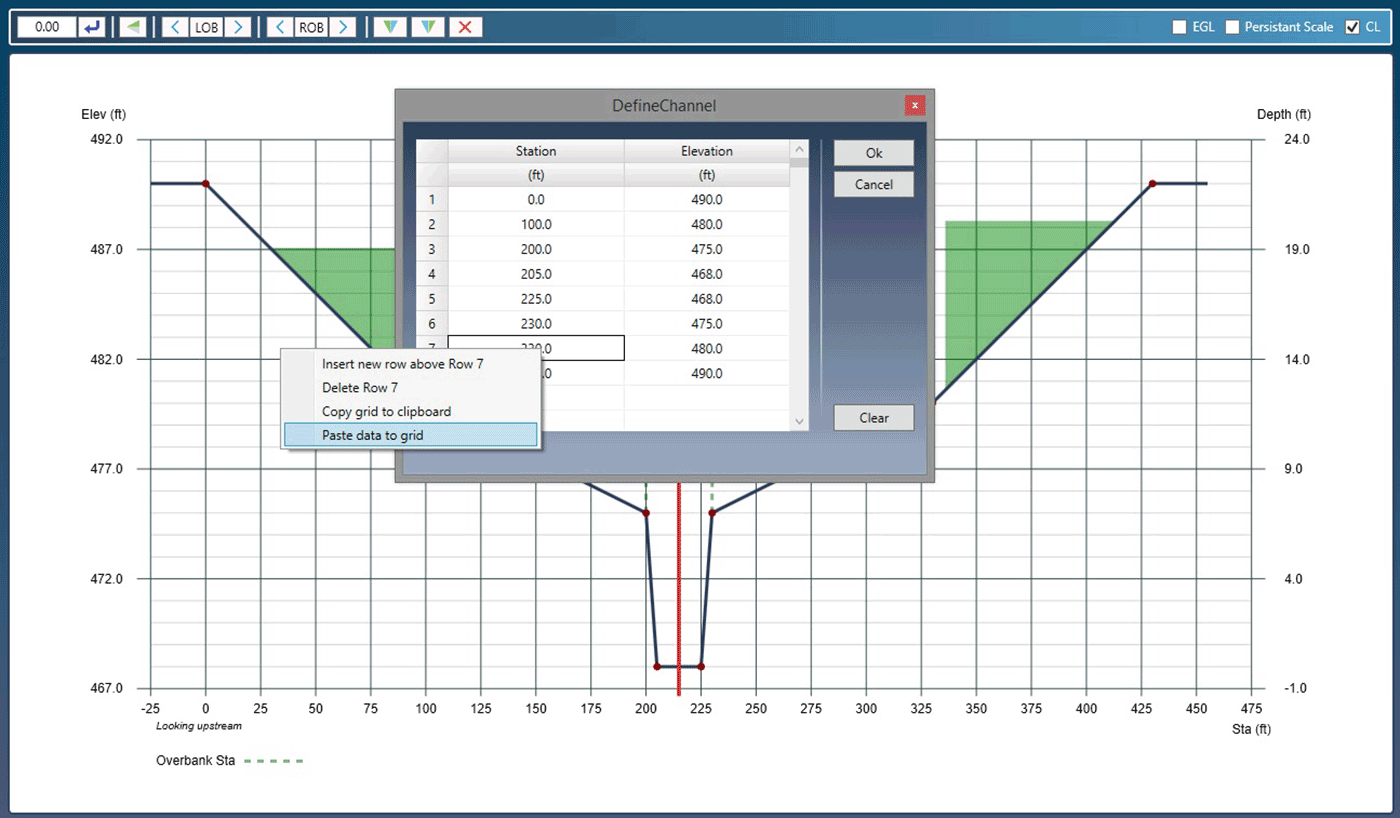
Easy Geometric Data Entry
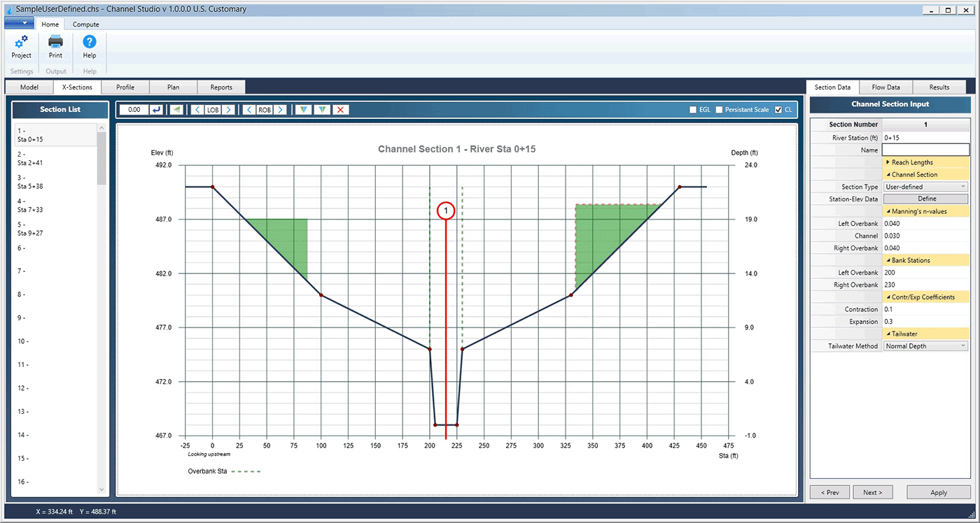
Simply select a section and input channel data. You can easily copy and paste station and elevation points from a spreadsheet, as well as insert, delete, or reverse section data. Additionally, you can copy data from one section and paste it into another. Moreover, you have the ability to adjust sections up or down and even interpolate between any two distinct sections.
Include blocked obstructions, Ineffective Flow Areas
Add blocked obstructions or ineffective flow areas to any cross-section. Great for modeling new buildings, walls, sheet piling or any other post-development structure encroaching the waterway. Define trigger elevations that make them permanent.
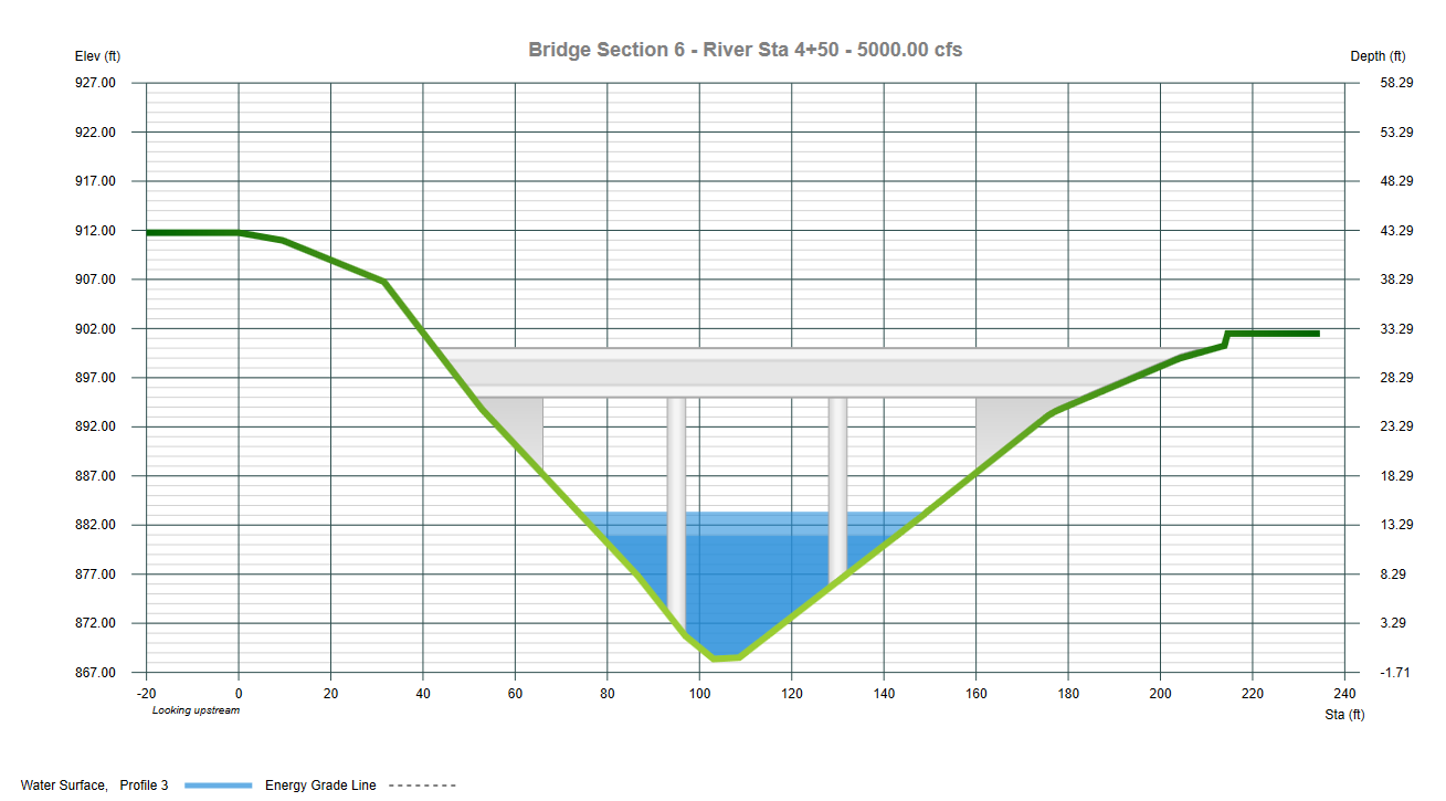
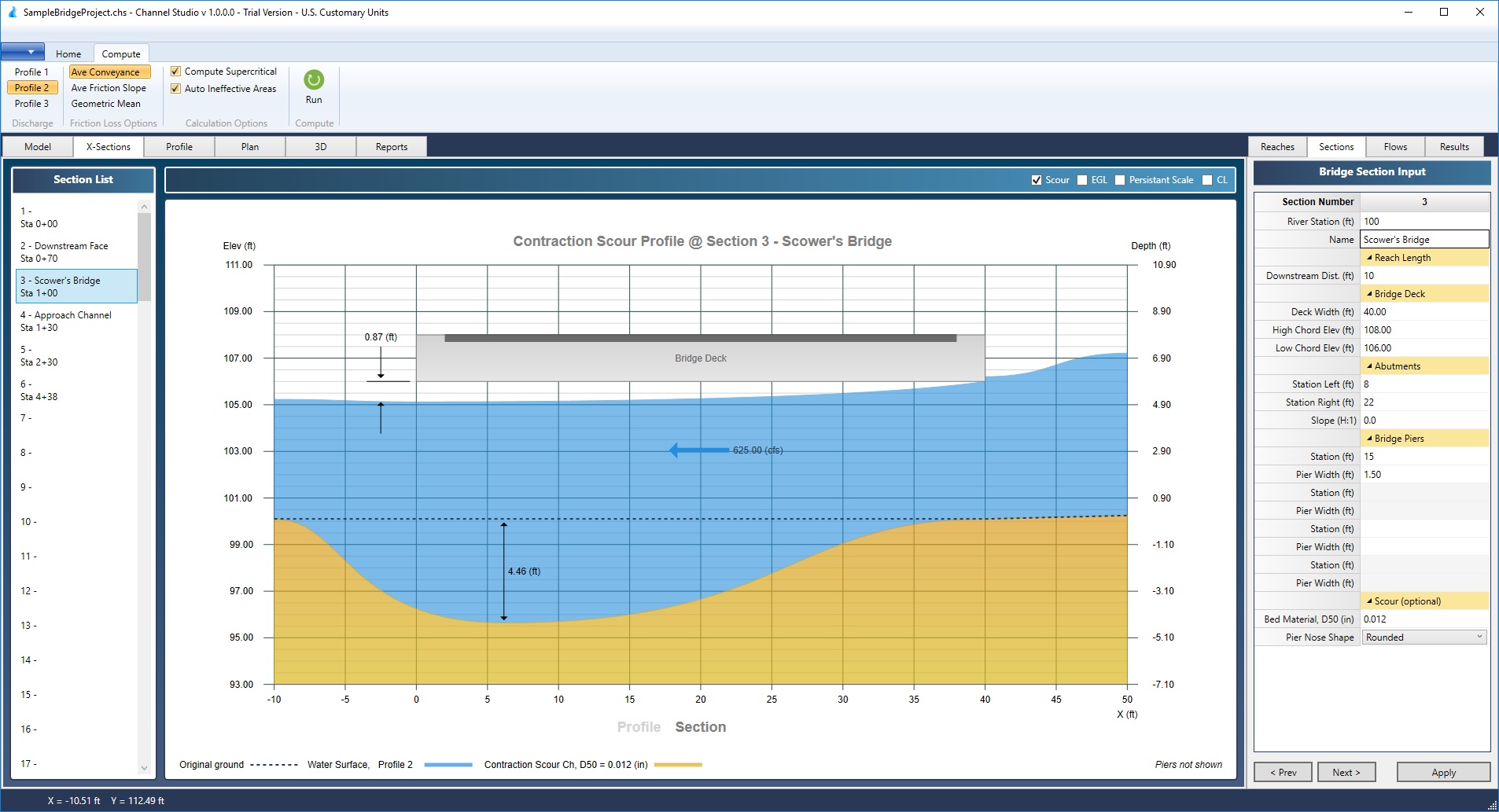
Models Bridges, Culverts & Inline Weirs
Any section can be a channel, bridge, culvert or inline weir.
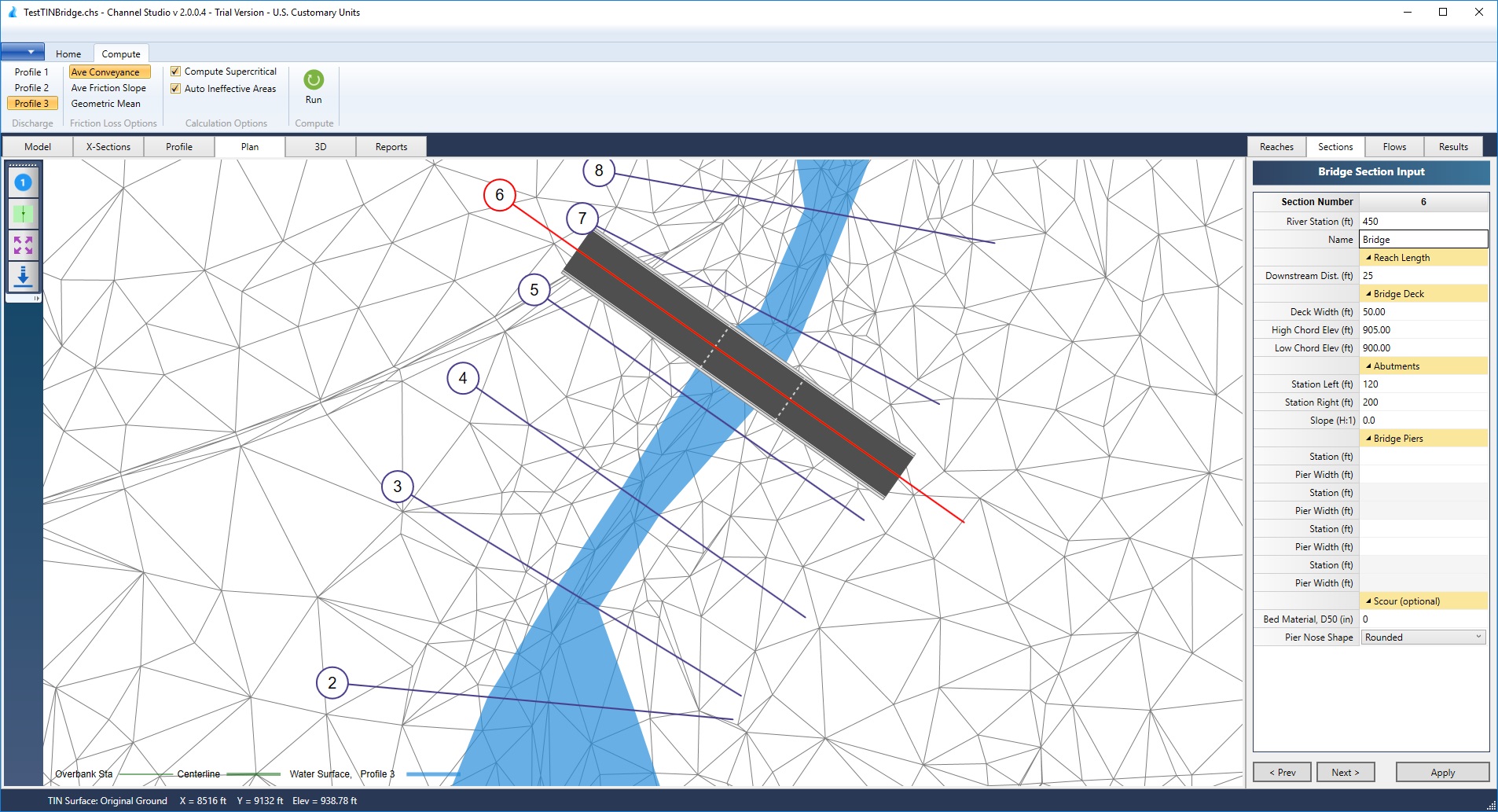
Comprehensive Bridge Hydraulics
Add bridge structures anywhere on your model and Channel Studio will manage the details like low flow, pressure flow and over-topping flow. Specify high and low deck elevations as well as optional sloped or vertical abutments and piers. The software optionally computes and includes ineffective flow areas for the adjacent channel sections. Includes Contraction and Pier scour.
Model Multi-Barrel Culverts
Add single or multi-barrel crossings with various shapes, inlet configurations, materials, slopes, sizes and flow regimes. Circular, Rectangular, Arch and Open-bottom Arch shapes can be modeled. HDS-5 methodologies.
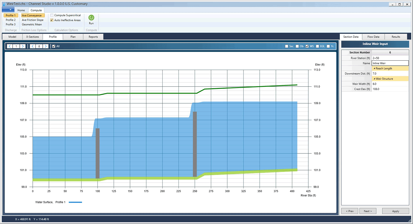
Model Inline Weirs
Perfect for when you need to regulate upstream water surface elevations. Just add an inline weir structure to your model and set the crest elevation. Channel studio automatically determines the weir type based on the computed water depth and weir width, and applies the appropriate weir coefficient, Cw.
Make Channel Studio your go-to software for open channel modeling
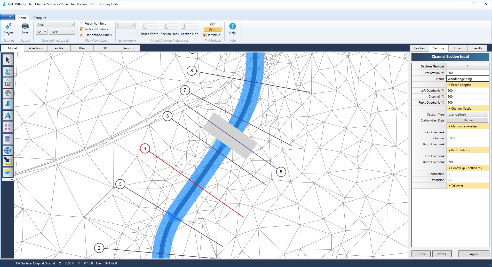
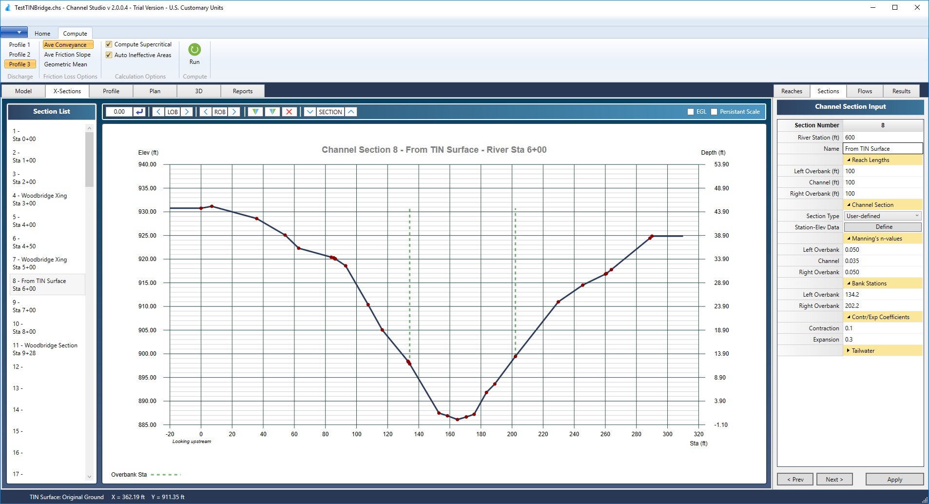
Cut Cross-Sections Over TIN Surfaces
There is no requirement to input section data points if a TIN Surface exists. Allow your mouse to handle the task. The data will automatically adjust as your cross-sections are modified.
Cut Cross-Sections Over TIN Surfaces
Import a TIN (Triangulated Irregular Network) file from your CAD software and Channel Studio automatically populates your cross-sections with geometric data that matches the surface. With a TIN surface present, you’ll never have to enter station and elevation points.
Import from LandXML or X, Y, Z Point Cloud
Channel Studio can directly import Surfaces from any LandXML file. Don’t have a LandXML file? No problem. You can use your raw field data. Just import a simple X, Y, Z point cloud file and Channel Studio will create a TIN Surface for you.
Export Back to a TIN Surface
Once your model is finished, you’ll have the option to export your channel system and water surface back out to a LandXML TIN Surface. Open up in any TIN-Surface supported CAD software for accurate and realistic floodplain mapping and delineation.
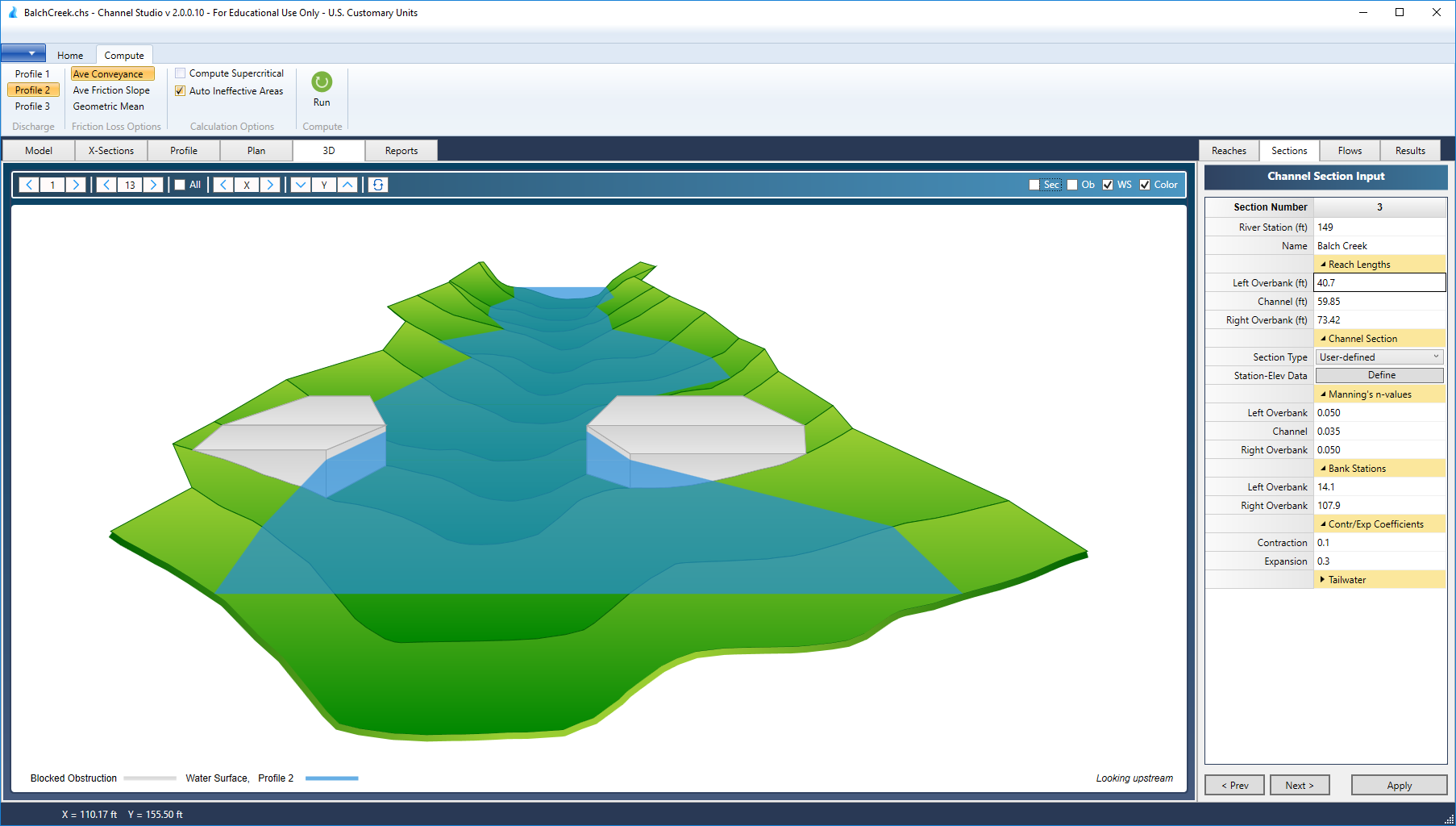
Plenty of Features for Power Users Too
Sophisticated calculation methods, bridge contraction and pier scour, 3-D perspectives and more.
Evaluates Bridge Scour
Channel Studio performs scour analysis through any bridge structure. Using methods per HEC-18, all it needs are bed material, D50 and a selection of pier shape if present. Live-bed and Clear-water equations are employed.
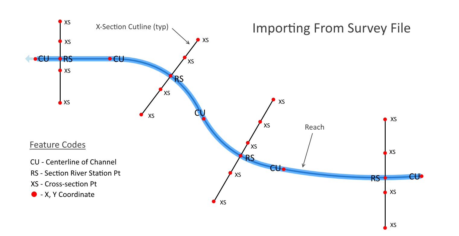
Import/Export RAS GIS Files & Raw Survey Data
Import data from RAS GIS Import and HEC-RAS Export files. Share your project with other RAS GIS-supported CAD software for flood plain delineation. Import your reaches and/or cross-sections from any .csv file containing Easting (X), Northing (Y), Elevation (Z) values and their associated Feature Codes.
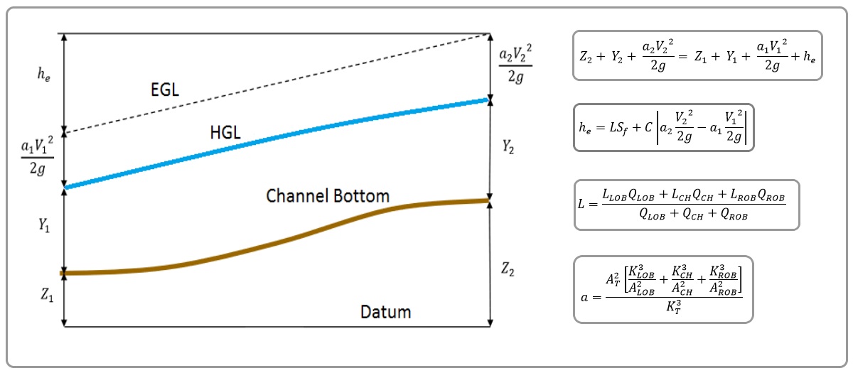
Time-tested Procedures & Calculation Methods
Channel Studio is not a HEC-RAS wrapper, but employs the same calculation procedures. It handles subcritical and supercritical flow with hydraulic jumps. It includes cross-section subdivision for conveyance calculations, composite Manning’s n across channel sections, velocity-weighing coefficients for Alpha, distance-weighted reach lengths and contraction and expansion losses. N-values can vary across sections via Left and Right Overbank stations. Includes three friction-loss methods.
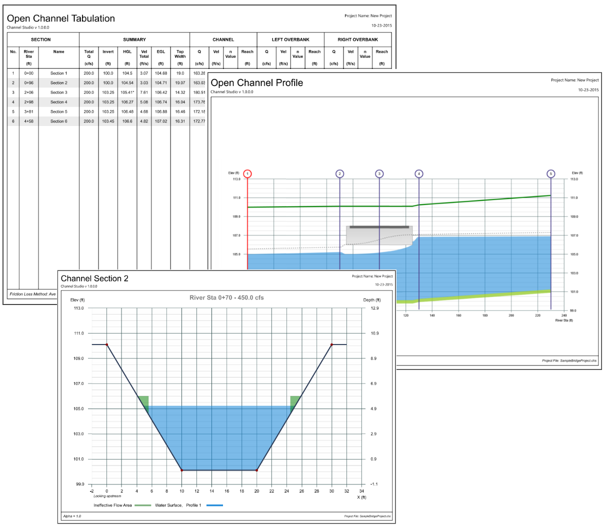
Expert Reports for Expert Engineers
Elevate your engineering game with top-notch print-outs showcasing your expertise. Indulge in high-quality plans, detailed cross-sections, precise water surface profiles, and organized tabulated reports.
Enhance your data analysis capabilities by exporting numerical reports as text or comma delimited files, allowing you to easily import them into spreadsheets for more personalized customization.
These designs are meticulously crafted to exude authority and ensure effortless comprehension by both your colleagues and evaluators.
Reaches
- Add up to 100 reaches at any length.
- Add up to 100 cross-sections.
- Reaches can be curved or straight.
- Automatically computes reach lengths with user override.
- User-defined canvas and map extents.
- Import reaches and sections from raw survey data.
- Import and export projects from RAS GIS files.
Channel Sections
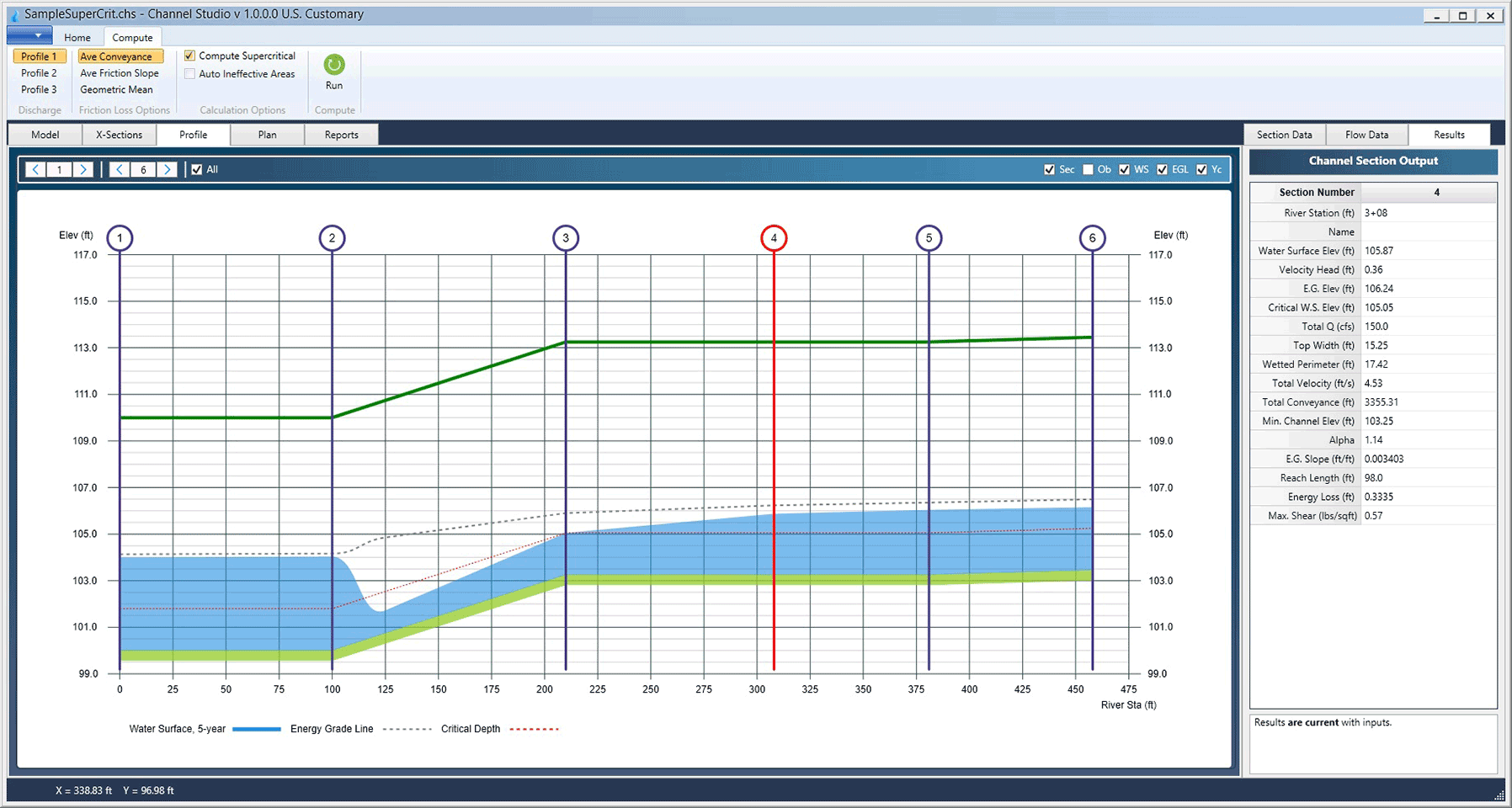
- Computes water surface profiles using energy-based procedures following HEC-RAS methodologies.
- Calculation friction-loss methods including Ave Conveyance, Ave Friction Slope and Geometric Mean.
- Compute using up to three unique user-defined flow profiles, each with varying Qs and tailwater.
- Up to 250 user-defined points can be used to describe User-defined channel sections.
- N-values can vary across sections via Left and Right Overbank Stations.
- Computes supercritical flow profiles with hydraulic jumps.
- Specify any known tailwater elevation, normal depth or critical depth as a starting control point.
- Automatically constructs and includes ineffective flow areas upstream and downstream of bridge and culvert sections.
- Allows you to graphically draw ineffective flow areas for any cross-section.
- Reverse cross-section data from looking upstream to downstream and visa versa.
- Copy and paste geometric data from other cross-sections to minimize user input.
- Interpolate cross-section data between any two sections for easy section insertion.
- Adjust geometric cross-section data up or down with a single input.
- Extracts cross-section points directly from a TIN Surface
Culverts
- Computes hydraulic grade line (HGL) with flow regimes including supercritical flow and hydraulic jumps.
- Models inlet and outlet control flow regimes.
- Computes roadway/embankment overtopping flows.
- Uses FHWA – HDS-5 methodology.
- Handles partial, full and surcharged flow regimes automatically.
- Models circular, rectangular, arch and arch-open bottom sections.
Bridges
- Computes hydraulic grade line (HGL) through bridge crossings.
- Specify high and low chord elevations, left and right abutments and multiple vertical piers.
- Abutments can be sloped or vertical.
- Computes roadway/deck overtopping flows.
- Computes contraction and pier scour.
Inline Weirs
- Computes hydraulic grade line (HGL) over inline weir structures.
- Weirs can represent emergency spillways or overflow structures. Broad or sharp crested.
Output Features
- Colorful, professional reports are easy to read and interpret.
- Georeferenced Plan, Section and Profile plots for easy floodplain delineation.
- Tabulated reports are exportable to .txt or .csv file formats.
- Finished Plan Views can be exported to .DXF, TIN Surfaces or a variety of image formats.
- Print Preview.
Units
- U.S. Customary
- Metric